Individual disasters capable of destroying one’s house, such as fire or an isolated tree fall, are solved by conventional means: temporary shelter while rebuilding, hopefully funded by insurance. First responder help is scant minutes away by a 9-1-1 call.
Here we address larger scale emergencies that affect at least an entire neighborhood, and perhaps an entire region. In such a case, the first responders will be overwhelmed and a 9-1-1 call will not be answered. We also only look at primary emergency situations. Any primary emergency will entail secondary sources for distress, usually human-caused. That’s a subject for another discussion.
Local Area Risk Analysis
Washington has four risks of natural regional-scale disaster: wildfire, extreme climate event (wind/flood/ice/snow), earthquake/tsunami, and volcano. Terrorism is the new and unnatural risk on the block, although acts of war have always been a background risk consideration.
Washington’s Cascade Mountains contain four active stratovolcanoes. The closest to us, Glacier Peak, is just 80km away and appears to be the most active of the lot. Its past lahars have reached Puget Sound, but flow down river courses just to the north of us. Prevailing winds will carry most tephra away from us as well. The geologic record shows Glacier Peak to have a recent frequency of perhaps 400 year intervals between eruptions, with a record going back thousands of years. It has been ~300 years since its last estimated eruption.
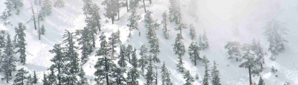
We need not fear a tsunami, flood, or lahar directly threatening our neighborhood. We live on just sufficiently high ground, at 60m elevation, although only 400m from the Sound, but >10km from a significant river. There are available routes out of the area in case of a flood condition nearby. Blizzard and earthquake pose our biggest risks of becoming cut off from needed resources for a duration of a week or more. Both also pose a threat of dwelling destruction on a community scale, with blizzard destruction possible due to associated tree falls. Our neighborhood is wooded by native conifers that are well over 100′ tall, many with potential for compromised root systems due to residential neighborhoods being developed closely in their midst.
While we have minimal need of flood insurance, earthquake insurance is a strong consideration. We live ~5km south of the Southern Whidbey Island Fault, a complex, multi-strand fault at least 150km long with historical evidence of a M7+ quake around 900 CE. We live uncomfortably close to the offshore Cascadia Subduction Zone, capable of a M9+ earthquake. It last ruptured in 1700CE and has an average quake interval of 500 years, with recent ranges of 200-900 years between quakes. Coincidentally, the last documented Glacier Peak eruption corresponds closely with the last documented great Cascadia quake, making a double whammy a possibility.
The Cascadia earthquake frequency is less than observed in the earth’s other subduction zones, indicating potentially greater stress buildup here and hence potential for larger quakes. All observed quake evidence indicates that each Cascadia zone rupture has produced a tsunami with capability of inflicting damage to coastal areas around the North Pacific.
Our neighborhood is developed but wooded, so wildfire is a remote possibility. But this region is home to a temperate rain forest, which is much less susceptible to wildfire than forested land in a drier climate. According to one online source, there are perhaps 20 wildfires noted for our county in the last 40 years. They likely only occurred between July and September. There does not seem to have been a wildfire in our area for well over a century of recorded development, and there is virtually no public discussion of such risk.
Terrorism emergencies would most likely involve attack on the electric grid or water supply. We are not close enough to any group or facility of strategic importance to put explosives on our risk radar, although WMD attack on Seattle would severely impact all surrounding territory.
Basic Risk Mitigation
Earthquake damage prevention involves securing anything in the home that can fall over (book cases, water heater) or tumble out (contents of cabinets). It further means securing a framed house to its foundation.
Wind damage prevention involves assessing all tall trees that could fall on one’s home, to ensure their root systems are healthy and the tree’s trunk and main limbs have no structural damage that might weaken it.
We can mitigate our own distress due to any disaster emergency by being prepared, with home exit paths and neighborhood egress routes preplanned, backup communications and energy sources available, gas and water turnoffs well documented, emergency supplies on hand, and a neighborhood recovery plan in place. Take care of ourselves, then take care of neighbors with special needs.
